Get your copy! “Operational Efficiency through Shared Geospatial Systems”
Get your copy of our 2015 Mid-Continent Digital Oilfield Conference presentation, “Operational Efficiency through Shared Geospatial Systems”. This presentation covers major industry trends, emerging technology tools and guidelines of delivery geospatial solutions effectively: Research summary on traditional problems in working with and making available geospatial data in the energy enterprise The reward for getting the data integrated and delivered in terms of productivity gains 5...
Read MoreR7 Solutions Presentation Announced for the Mid-Continent Digital Oilfield Conference February 18 in Tulsa
R7 Solutions’ CEO, Kraettli Epperson, has been invited to speak at the 2015 Mid-Continent Digital Oilfield Conference, hosted at the Hyatt Regency in Downtown Tulsa. Mr. Epperson will present a session on”Operational Efficiency Through Shared Geospatial Systems” on Wednesday, February 18th, the first day of the conference. The Mid-Continent Digital Oilfield Conference is an annual event that focuses on how digital technologies have improved and changed the oilfield...
Read MoreHow does R7 Solutions win new clients? Check out our CEO in Inc. Magazine
At R7 Solutions, we understand that delivering quality to our clients does more than make our clients happy: It also wins us our next client! CEO Kraettli L. Epperson was quoted this month in Inc. Magazine about how we win new clients: “Provide personal endorsements.” “The most effective thing we’ve done is to provide clients with personal endorsements from existing clients. These references can be a few sentences, case studies or direct telephone calls....
Read MoreGrowing Telecommunications Company adds GeoIntelis to Toolkit
Oklahoma City, OK, August 1, 2013 – Rapidly growing regional telecommunications company, uTphone, has added GeoIntelis to its toolkit, helping to fuel in-depth analysis and strategic planning. GeoIntelis provides telecommunications companies with a fully managed geospatial and workflow solution for locating, mapping, analyzing and planning around their customer locations, asset locations, and partner or acquisition assets. About uTphone Inc. uTphone Inc. is a wired and wireless...
Read MoreDesigns for Houston Light-Rail Lines Approved
Houston, TX, September 11, 2013 – Houston METRO has launched the new Light Rail Lines that were designed and are currently managed in GeoIntelis Enterprise! The focus of the METRO rail expansion project, first proposed in 2009, is to expand the 7.5 mile light rail Red Line with the addition of three lines: The Green Line for the East End of Houston, the Purple Line for Southwest Houston, and an extension of the Red Line to North Houston. Today, METRO conducted electric power tests on...
Read MoreCoates Field Service Deploys Custom GeoIntelis Solution
R7 Solutions developed a custom GeoIntelis solution for Coates Field Service that combines all the power and features of GeoIntelis Pro with real-time synchronization with internal project tracking databases managed and maintained on-site at Coates Field Service. The system connects to the company’s project tracking database 4 times per minute, providing real-time information without overloading bandwidth or server capacities. The geodatabase designed for the project mirrors the...
Read More1804 Operating Completes Geospatial Analysis of Disposal Wells
April 20, 2012 – R7 Solutions has completed an engagement with energy industry operator of saltwater disposal wells, 1804 Operating to provide in-depth geospatial analysis services. This project focused on the optimization of 1804 Operating’s growing saltwater disposal well investment portfolio. The company is seeking to better service clients and provide more efficient access to saltwater disposal facilities for the rapidly expanding hydraulic fracturing industry in North Dakota....
Read MoreHouston METRO Purchases GeoIntelis Enterprise
The Metropolitan Transit Authority of Harris County, known as Houston METRO, has purchased a software license to GeoIntelis Enterprise and engaged R7 Solutions to design and build a customized workflow management system based on the software. The purchase of a GeoIntelis Enterprise License was recently authorized by the METRO Board of Directors. GeoIntelis is being used as a right-of-way management system and land lease management system, as well as for long-term land title, infrastructure and...
Read MoreCoates Field Service Expands Client Services with GeoIntelis
We are delighted to welcome Coates Field Service as users of GeoIntelis. CFS is using GeoIntelis to perform rapid parcel counts and ownership reports on a complex multi-hundred-mile right-of-way project, the system provides CFS with a fast mapping and land data management solution. Thank you very much. You guys did a really good job with an unusual project brought to you in less than desirable circumstances. I really appreciate the good help. – Joe Coates, President, Coates Field Service...
Read MoreIncident Mapping – Tracking Wildfire Emergency in Central US with GeoIntelis
While serious crisis unfold in Libya and Japan, there is also a wildfire outbreak in the central US. The governor of Oklahoma declared a statewide emergency a few hours ago, and response crews are currently mobilizing. We are using GeoIntelis to track and monitor this outbreak in real-time in order to protect client personnel and assets who may become threatened. Using US infrared satellite data we are tracking North Texas and Oklahoma wildfire locations against pipeline and oil and gas asset...
Read MoreGeoIntelis Launch!
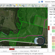
We are pleased to announce the launch of GeoIntelis, our new web-based geographic information and workflow management system. That is a mouthful. So what is GeoIntelis, really? GeoIntelis is the distillation of 10 years of experience building GIS, document management and workflow systems for both large oil and gas companies and small real estate development companies and local governments. GeoIntelis is a flexible, powerful, easy-to-use web-based GIS that is both affordable and...
Read MoreCompletion of Service Delivery for GeoInfo at Hess Corporation
R7 Solutions is pleased to announce the completion of delivery of services to Hess Corporation in support of that company’s GeoInfo application. Built on top of ArcGIS Server in ASP.NET, GeoInfo allows Hess Corporation to quickly catalog, search, download and review complex geophysical data for worldwide oil and gas exploration and production operations. We love to work with you. We know we can talk with you whenever we need and you are very flexible, so we don’t have any problems...
Read More


